
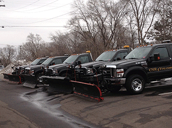
 Residential Winter Summaries
 As we progress through our Minnesota Winter, C N' R will post snow removal summaries for residential properties in this location. Be sure to check back here often as the snow flies for snow plowing, salting and shoveling updates.
 |
 |
Recent Update -
3/15/26 : 10.5” (Rare Blizzard Warning, therefore a lot of drifting
snow)
This storm system was forecasted to bring about 10-20 inches of snow for the
Twin Cities metro, and thank goodness it stayed on the lower end of the
range. This was a Saturday into Sunday snowfall, that helped as well as
people more or less hunkered down on Sunday because of this well advertised
storm system. Operations did go into Monday as well with this snowfall, and
is now the largest snowfall of the season, and the largest in 3 winter
seasons.
Overall, CNR was prepared. We did get hotel rooms for a couple nights close
to our accounts for most employees. This is due to the dangerous nature of
this storm system, and being sure all workers did get to work, and also had
a resting spot. CNR basically did this in 2 shifts, some 3 shifts were taken
and all customers did receive an email from Craig explaining this and a lot
more. So, as far as communicating and being prepared, we feel good about the
action taken early to be sure we were successful with snow removal
operations for a storm like this.
Around 10 inches fell around our accounts. The wind was relentless and
really blew things around, from yard to yard area, off rooflines, etc. It
was very bad in some areas and got very deep. So, we feel charging the 10”+
category was very fair for this event.
Break downs? Yes, we had breakdowns, plenty of them. We had vehicles getting
stuck. We run smaller vehicles as well (Jeeps), and they really struggled as
well. But we dug & grind our way through it all as this is typical for these
types of storm systems.
As far as residential driveways, they were all plowed 3x during this storm.
Of course the first 2 times were “openings” (not complete plows). Final plow
was touching up end of drives, and any lingering snow from snow falling
and/or blowing. The City plows went out a couple/few times, and we fell we
kept up nicely with that.
Shoveling? Some sidewalks were shoveled 1-2 times, and some shoveled 2-3
times.
Salting driveways was done for driveways that needed it.
November
Wednesday, November 26 : 0.4"
According to the National Weather Service, we were supposed to get about
4-8” of snowfall with this system. We did get a lot of rain, then it finally
changed over to snow, and it did snow pretty hard at times. But, the very
warm surface temperatures (even at night) won out. There were many areas
around the Twin Cities that received 1-3” of snow, more to the north, but
around C N’R’s accounts, there was a pretty large pocket of less than a half
inch. During the early morning hours of 11/26, at 2:30am - any accumulation
was not measurable at that time. At 5:30am, it was wrapping up and still,
the warm surface temps kept totals below 1/2 of an inch. The big “but” about
this is that fact that there was a lot of wind with the back end of the
storm, so there was some decent drifting off roof tops, or simply from the
lawn areas. This drifting did make for a bit more in some driveways, but it
also made some driveways with less than a quarter inch of snow. So, we
called it 0.4”.
This snowfall did not hit our 1.0” threshold.
I was a borderline “light snow” threshold if you are signed up for that
(0.5” or more) - but due to the warm soil/grass temps, we absolutely did not
want to plow because of all the sod damage that could have been likely. We
need it to freeze.
What we did do for residential properties is if you are signed up for
driveway salting, we did complete all of these accounts. If these accounts
had a bit too much snow on them, then we plowed it quick and then put down
the salt.
11/29/25 : 5.0"
STORM DETAILS: We had super/very light snow for most of the
day on Saturday, 11/29. That is why we are calling it the 11/29 storm,
although most of the work was done on 11/30 after the snowfall. But, with
the snow rates so light for the entire day on Saturday 11/29, it did not
amount to a lot. By 3pm-ish, we had about 2” on the ground. Then between
about 3pm-8pm, the snow did get a little heavier per se and by 9pm, we had
about 3” on the ground, and then maybe 4” by midnight. Then, the snow died
down sometime in-between that 10pm 11/29 & 2am 11/30 timeframe. Then around
5am on 11/30 (early Sunday morning) - we receive a snow squall warning for
the eastern metro on our APP’s and we were very surprised by this. As this
was happening, it expanded to western metro as well without notice and all
of a sudden we receive another 0.5” - 1.0” of snow until about 8am Sunday
morning. What a long duration snowfall we had, but with only about 5” total.
Some places within our route arguably had about 4-4.5” of snow and some
places were closer to 6” in the end. We are calling it 5” and will be
invoiced as a category B snowfall.
RESIDENTIAL OPERATIONS: With the longevity of the snowfall,
you would like we would have plowed 2x just naturally. But because when we
thought it was about to be done and there was barely 3” on the ground at
that time, the intention was to just plow 1x. It says on our agreement that
with 3” of snow, we will come one time at the end. Then we received more
snow through the evening, and then received the suppose snow squall early
Sunday morning 11/30 as talked about above. And in the end, if we knew we
were getting 4-6 inches of snow, we would have done some driveways 2x no
matter what, it just did not work that way. And collaborating with our
friends in business, residential plow companies (just like CNR) had it
planned to plow all driveways 1x at the end. And then to make it more
confusing, due to the late night/early morning snow surprise, we ended up
plowing all driveways again just because it was another 1/2 inch to 1” that
fell early Sunday morning. We are guessing that a lot of homeowners woke up
Sunday morning thinking the snow ended at midnight and we should have had
everything perfectly cleaned up, but that was not the case. Yes, we got a
break from snowfall overnight, but moderate snow moved in between about
5am-8am Sunday morning and made some driveways look like we have not been
there yet, and that was not the case.
Operations for snow plowing and snow shoveling lasted until about 2pm early
Sunday afternoon 11/30.
Salt was used when needed on driveways where customers were signed up for
this service.
Go to: November December January February March April
December
12/3/25 : 0.5"
We had about a 5 hour period of very light snow during the late evening of
12/2 from about 8pm until 1am the next morning (12/3).
Craig drove to several neighborhoods and only could measure right about 0.5”
of snow, no more unless we measured over an area that was snow packed
already, then you may be able to measure 0.75” of snow. Anyways, this event
was only half way to our trigger threshold of 1.0”. So, if you are only
signed up for 1.0” service or more, then you were not serviced for this
event.
If you are signed up for our “light snow 0.50” - 0.99” special request
service, all these properties were plowed/shoveled and salted if you are
signed up for salt.
If you are not signed up for “light snow” service but you are signed up for
salting service, we did salt areas/driveways in need.
All services were completed between about 5am & 10am on 12/3.
12/5/25: 1.0"
SNOWFALL? From about 7am-ish on Friday, 12/5 until about 1pm-ish - 2pm-ish -
we had very light snow. This amounted to just over an inch of snow.
Residential driveways and sidewalks were cleared from about 1-2pm-ish until
about 7-8pm-ish.
Salt was use if signed up.
12/8/25: 0.5"
On Saturday night into early Sunday morning, we had a bad of snow push
through that left us with less than a half inch of snow. This was on 12/6
into 12/7, then on the morning of 12/8 between about 5am-7am, we had another
band of snow move through which pushed us over the top of a half inch total
between the 2 events. Therefore, we completed our “light snow” schedule
which is snowfall between 0.50” - 0.99”. Because it has been so cold between
these 2 snowfalls, and they were so close together, we did drive around and
check some driveways out to see what they were holding. Plus no melting, so
this was a decision based on the 2 snowfalls and observations. Shoveling
that goes along with the plowing was complete, and some salting, but not a
lot because we currently have plenty down.
12/8/25: 1.0"
On Monday, December 8, we had a band of snow move in around 5pm and lasted
until about 8pm. About 1” fell from this band on top of what we had that
morning as well if you look at the last snow summary. Craig actually
officially measure 1.1” in Eden Prairie from this new band.
Plowed all residential driveways that night.
Shoveled all residential sidewalks (if you are signed up) that night.
No “end of drives” - because of the next system moving in the next day, we
just did our plowing and shoveling and went to bed to prepare for 4-8” of
snow starting the next day (afternoon).
No driveway salt was used for the same reason.
12/9/25 : 4.5”
Most of the snow on this event fell from 1pm 12/9 until 7pm 12/9. Another
“sneaky” 1-2” fell from about 11pm 12/9 until about 3am early morning of
12/10. We also received another small band of snow during the morning hours
of 12/10 - so that added a bit more. Due to this storm having multiple
bouts, it took a lot more work to get things cleaned up & residential
properties were plowed 2 full times.
To sum it up, we did multiple rounds of plowing residential driveways
starting around 7pm on 12/9 and lasted through about noon on 12/10. Same
with shoveling - most places were shoveled 2x.
Driveway salt was used where needed.
End of drives were done.
Early morning - 12/18/25 : Rain, flash freeze preventative
During the night of 12/17 into 12/18, we had several bands of rain move
through within the warm sector of a strong Alberta Clipper that was racing
across the international border. Temps had risen to close to 40 degrees over
night as the rain came through.
Waking up early on 12/18 (Thursday) - the final band of rain was about to
end around 7am and things were very wet out there in the middle of December.
Next to come in was the forecasted cold front which was supposed to drop our
temps to below freezing by noon and then fall about 3-5 degrees per hour
through the late afternoon and evening.
This is a scenario where “flash-freeze” is a big concern, therefore we went
out to treat all driveways/some sidewalks with salt (if you are signed up
for this service). There was no ice upon treatment, but things were very wet
and about to freeze solid.
A couple things about the rain/wetness:
Due to the rain, this washes away all salt residual. This is important
because it will not work once things freeze again. So it is very important
to get the salt put back onto the pavement/sidewalks.
Also, even though things were not frozen yet, one would say: “What is the
point of putting salt on wetness/water? Why not wait for it to freeze?"
Answer: When you get a flash freeze and temps are dropping that
significantly, it is more difficult and slower to melt the ice once it has
frozen. When you apply salt while wet, it also soaks up the water, therefore
surfaces won’t even freeze if they have dried.
12/19/25 : 1.2"
We had more snow move in on the cold side of a pretty potent Alberta
clipper. The snow came with very strong winds, actually breaking records for
gusts in MN, SD, and ND for this time of the season.
This wind driven band of snow made it here on Thursday, 12/18 at about
3pm-ish, and lasted until 7-8pm that evening.
In the end, it was tough to measure, but we did get a median for multiple
measurements of 1.2”. The airport was 1.1”. And Chanhassen reported 1.0”.
All residential driveways and sidewalks (if you are signed up) were cleared
12/18 into 12/19.
Salt was used when needed, but sparingly due to just putting a bunch of salt
down about 12 hours earlier on the front side of this storm system in the
warm sector prior to the “flash-freeze”. See past update dated 12/18.
End of driveways were not completed due to most of the cities not going out
to plow. This snow was light, yes, but it was dense. Plus, when driven on,
it really compacted to the pavement, therefore we are not surprised many
city plows did not plow many streets because not much would come up. Plus,
if they did in your particular neighborhood, it did not leave much at the
end of the driveway.
12/22/25 : FRZ rain, 0.1” of ice
Between about 3am & 5:30am on Monday morning, 12/22 - we were under a
freezing rain advisory for 0.1” of ice with this band of sleet and then rain
that moved through falling on top of froze pavement temperatures. It coated
things with sleet, ice, and slush. We salted driveways and some sidewalks
that needed it.
NON-EVENT NOTES: 12/25, 12/26, 12/27, etc….
As the Christmas holiday went by, we were in a warmer airmass just a bit
above freezing, but we continued to get bouts of dense fog, turning into
freezing fog. Bands of rain which made things very wet, then the temps would
drop close to freezing, etc. This happened for multiple days in a row,
especially 12/26 & 12/27 which was a Friday (work day) and the following
Saturday. During this time period, C N’R did not do any “regular” salting to
any residential driveways and/or sidewalks because December has been an
extra ordinary month with a lot of events which included round after round
of salt, and to keep December invoices down some, we have been electing to
pull back on the salt and only salt if a customer specially requested it
during this time period.
12/28/25 : 6.0” (seriously wind driven)
This was more or less a blizzard situation, especially for all the counties
immediately west of the Twin Cities where they had blizzard warnings, but
for the metro, we stuck with winter storm warnings for 6”+ snowfall along
with winds gusting as high as close to 50 mph at times. The actual sustained
winds were the most impressive to us because it just would not stop blowing
very hard, and then you get a gust that could knock you off your feet.
All the snow fell on 12/28 (Sunday).
Details:
7am-9:30am - freezing rain to snow.
Temps then started to drop fast with the winds coming in, created flash
freeze conditions.
Then a very heavy band of snow until about noon-ish or so, then it was just
off and on light to moderate snow until about midnight-ish. Some snow
showers after but the wind was blowing so hard, it was tough to tell if it
was snowing or if it was just blowing.
A “tough to measure” type of storm, but the winds made for more snow in many
areas than actually fell because you have regular blowing and drifting, you
have snow blowing significantly from roof tops whether it is a house or a
commercial building.
All residents were plowed 2x. On our second round of plowing and after our
second round of plowing, we did focus on end of driveway clearing. We did
apply some salt to driveways, but with all the wind, wind chill, etc…it was
not doing much, so we used sparingly.
Most sidewalks were cleared 2x as well if you are signed up for that
service.
12/31/25 : New Year’s Eve = 1.25"
During the morning hours of Wednesday, December 31st - we
received another 1-1.25” of snow from a clipper system. Most of the snow
was done by about noon/1pm that day, and we plowed/shoveled all
residential driveways until about 7/8pm that evening.
We did use Salt when needed & the City Plows came around as we were
plowing or just after, so we went around to be sure all end of drives
were cleaned up.
Go to: November December January February March April
January
SUNDAY 1/4 - TUESDAY 1/6 : Freezing precipitation
Monday night 1/4 into early morning Tuesday 1/6 = this was a pretty
incredible January rain, with ground temperatures frozen, and air temps
hovering right around 32 degrees, nearly 1/2” of rain fell with a band that
moved through. Right away, it started to create VERY icy conditions, but as
the rain did get heavier, it started to decrease the amount of icing there
was. But there was a lot of water, dense fog, moisture hanging around after
the rain ended, then things started to freeze again.
Driveways turned pretty darn icy as well and we needed to HEAVILY treat
residential driveways. Some driveways were very thick with slushy ice. If
you are signed up for this service, you were salted during the early morning
hours of Tuesday, 1/6.
1/8/26 : Rain that froze
On Thursday evening, 1/8, we had a storm system to our south that moved just
enough to the north to cover the metro with plain old rain. There were some
forecasts stating that it could switch to snow, so we were on call through
the event, but temps and dew points just did not fall enough to switch the
rain to snow. So, again, just a plain old January rain with temps right
around 34 degrees during the event, but after the even ended around 9/10pm
that evening, temps dropped into the 20’s through the rest of the night and
the next day temps did not rise above freezing.
We then went around to all driveways were customers are signed up for
salting and salted the once in need. If a driveway was drier, we did not
salt it. If a driveway (most did) had a thin layer of ice on it from this
rain freezing, we salted it. Also, we re-salted driveways that had thick ice
on them from before to keep working on thawing these particular driveways
out.
All work was completed between about 6:00am - 10:00am on 1/9/26 which was a
Friday.
1/16/26 : 1-3"
On Friday, 1/16 - snow slowly fell for most of the day, and a “micro” heavy
band developed basically right across CNR accounts where more like 2-3
inches fell. This amount of snow was not on all accounts, so if you did not
have 2-3” from this band, then you were at about 1-1.5 inches.
This micro band set up in a NW to SE line from about Buffalo to Maple Plain
to Minnetonka area and N. Eden Prairie.
This snowfall lingered and lingered and lingers, lasting until about
midnight 1/16.
All plowing/shoveling was complete the next morning 1/17.
Salt was used for most properties that are signed up.
City plows did come out, so the “end of drive” charge will be in effect.
1/18/26 : 1.0” - 1.5"
Very light snow fell on Sunday, 1/18 between about 8am & 5pm. Similar to
last event, it was just a slowly accumulating snowfall that added up to at
least 1.0” (1.1” in Eden Prairie) - but there were some measurements close
to 1.5 inches.
Although this snowfall was very similar to the previous event on 1/16, the
big difference was how it ended.
HOLY COW! Big time winds! When the snow ended, big winds blew from about
5-6pm 1/18 until about 2am 1/19.
AND THEN, the temps plummeted!
Residential driveways were completed between about 5pm-11pm on 1/18. We
understand that there could be some “blow-back” from the winds after we
plowed, but we did not think it would be really bad - just depends which way
your house/driveway face, etc. We do not include “wind plowing” as part of
snow removal operations/agreement. Customers can request CNR to come back
for an additional charge if more snow blows into the driveway/sidewalk.
END OF DRIVES? Eden Prairie City, Edina, & SLP came out, Tonka did not
unless Tonka came out the next morning, so we are not charging for any end
of driveway work in Minnetonka.
Salt was used on some driveways that needed it.
1/21/26 : 1.0” of snow
Period of snow fell through the day on Wednesday, January 21st. It has been
cold, so we did a combined measurement from the previous days light snow and
this light snow and we ended up with around an inch between both systems
which were about 24 hours apart. Therefore we plowed/shoveled all driveways.
Re-applied salt on driveways due to temps SEVERELY DROPPING, and did end of
driveways as well for most, but some Cities did not come out until 12 hours
after the now had ended, and we were done plowing by midnight that night
(6-8 hours after the snow ended).
Go to: November December January February March April
February
2/1/26 : 2.0"
About 2 inches of snow fell during the early morning and daylight hours
of Sunday, Feb 1. Several bands came through, with some breaks inbetween
- this happened earlier. Then a more widespread band moved through about
9am-1pm-ish on Sunday. Some freezing wet precipitation mixed in as well,
but all n all, about 2 inches of snow.
This was a “lighter” snowfall, therefore before starting any operations,
we wait for all the snow to be done falling which was about 1pm on
Sunday, Feb - give or take.
Then we plowed/shoveled all residential driveways/sidewalks. The temps
did warm during the day, but dropped fast at night to single digits, so
we did apply salt to accounts signed up for it.
End of driveway clearing were done during the plow and also after,
depending on the city.
2/19/26 : 7.0"
DETAILS ABOUT THE STORM ITSELF:
Late Tuesday (2/17) night into early Wednesday (2/18) morning, we had a
bunch of bands/scattered RAIN showers move through and even a bit of thunder
for some close to home as we were on a warm side of a stronger low pressure
system moving in. This LOW continued to spin over Minnesota there after and
create quite large amount of snow along the north shore as the upper air was
flowing from SE to NW over lake superior. This enhances (lake effect) the
snowfall up there, as this LOW basically sat in Central MN and spun.
Around 8-9am on Wednesday (2/18), the rain became snow and remained snow for
basically the rest of the time. But, it had been so warm for a longer period
of time before this snowfall came (more on the warmth below) - it was just
wet on roads. It was even melting on contact on raised items and grassy
areas for the rest of the morning.
As the system gathered some strength and started “banding”, the snow became
more steady during the afternoon and about 1-2pm-ish is when we started to
get accumulation on grass, raised surfaces, and eventually pavement. Keep in
mind, this system was supposed to be “no accumulation expected” from all
weather outlets. All of a sudden we have about 2-3” on everything by about
5-6pm that Wednesday evening. There were big differences in forecasts on
when it was supposed to stop snowing. Guidance started at 9pm Wednesday
evening it was supposed to be mostly done. Then switched to midnight. Then
switched to 3am, and then the final Winter Weather Advisory change to 8am.
Wow! It just kept snowing all night and into Thursday morning without really
any warning.
On the south side of the spinning low, it wrapped in just enough cold area
and created a thin finger of snow that again “banded” and just sat over the
top of the SW twin cities for the entire night. It was actually crazy to see
if you were in one of our trucks witnessing a relentless band of snow that
just kept spitting out moisture. With this band, of course it set up right
over the top of the cities that CNR services and by 7:30am on Thursday
morning, we had a total of about 6-8”. Very close to 8” of snow in many
spots, at least 6-7 inches in all spots that CNR services. Crazy!
OPERATIONS FOR RESIDENTIAL:
When this system was all of a sudden creating accumulations, this occurred
at the worst time during traffic on Wednesday (2/18) afternoon. We were
still thinking at 3pm that day that we may not even be plowing, so all
employees of CNR were on call and waiting to see what happens. When we did
figure out that we will be plowing this, we started to call workers in, but
at that time, it was a mess to get in, and it took hours just to get most
people in. If you remember, all the roads became glare ice and it was
horrible with car after car in ditches, highways/back roads all blocked up.
Could not get anywhere. This ultimately delayed our starting time, but
nothing we could do about it. Between about 4-8pm is when slowly but surely
we got operations going, just depends on what person/truck and how long it
took to get in. There were a few workers that we told to hold off on driving
in until “after traffic” because how dangerous it was. We would rather start
a bit late than lose workers coming in with accidents, or sliding off roads,
etc. But, going back to what we eluded to earlier in this blog, at that time
calling everyone in, we were thinking that most of the accumulation was
supposed to be done by 9pm or midnight at the latest which totally became
VERY inaccurate.
In the end, through the night of Wednesday (2/18) and through a large chunk
of the day on Thursday (2/19), all residential driveways were plowed 2x
thru. If you are signed up for snow shoveling of sidewalks, most of these
were completed 2 times as well. The first round of plowing/shoveling got
about 3-5 inches cleared, and then the 2nd round was about 2-4 inches, give
or take.
Driveway salt was used when needed, not all needed it because of the warm
surfaces prior to the storm, but some really needed it and it was super
slippery in areas because the snow started to freeze/adhere to the pavement
as temps slowly dropped to the upper twenties over time.
SPEAKING OF WARM SURFACES:
Keep in mind, the prior 4-5 days, we had temps around 50 degrees. This
melted all our snow cover except for snow piles and thawed out the top of
the grass. This made it SUPER difficult to prevent damage. And again, as we
always say, it is not careless when you see grass chunks or black dirt
within the snow. Most of the time, it looks worse that it really is. I am
Craig LaRoche, the owner of CNR, and I have 33+ years of experience, and
while out with the crew (like usual) - I was having a tough time pushing
snow onto the grass without some damage. The weight of the snow getting
pushed over the grass (not the blade, but the snow pile pushed up) - this
was pealing up grass. That was how soft it was. And for some driveways, when
a tire briefly falls off the driveway, it would create a tire track. These
situations make us look bad in the end, and we totally understand that
customers do not want to have damage done. Never our intentions. Please have
patience with this during these types of events with soft ground. We are
doing our best and TRUST ME, I am teaching and continuing to state to all
drivers to be as careful as possible.
End of driveways were cleared later on as well, as we went through our 2nd
round of plowing, and even had to go back to a bunch of areas after our
second round because once again, a lot of Cities are slow and lazy.
2/24/26 : Freezing rain
Between about 10am - 11am on Tuesday morning, February 24th - we
received a thin band of frozen precipitation. Started off as sleet, changed
to plain old rain, then brief snow on the tail end. Lasted about an hour or
so overall. But the temps were in the upper 20’s and the surface temps were
well below freezing due to the recent cold spell we have had. Therefore
everything froze on contact where salting was required.
We then salted all residential driveways between about 11am-3pm that day
Go to: November December January February March April
March
3/15/26 : 10.5” (Rare Blizzard Warning, therefore a lot of drifting
snow)
This storm system was forecasted to bring about 10-20 inches of snow for the
Twin Cities metro, and thank goodness it stayed on the lower end of the
range. This was a Saturday into Sunday snowfall, that helped as well as
people more or less hunkered down on Sunday because of this well advertised
storm system. Operations did go into Monday as well with this snowfall, and
is now the largest snowfall of the season, and the largest in 3 winter
seasons.
Overall, CNR was prepared. We did get hotel rooms for a couple nights close
to our accounts for most employees. This is due to the dangerous nature of
this storm system, and being sure all workers did get to work, and also had
a resting spot. CNR basically did this in 2 shifts, some 3 shifts were taken
and all customers did receive an email from Craig explaining this and a lot
more. So, as far as communicating and being prepared, we feel good about the
action taken early to be sure we were successful with snow removal
operations for a storm like this.
Around 10 inches fell around our accounts. The wind was relentless and
really blew things around, from yard to yard area, off rooflines, etc. It
was very bad in some areas and got very deep. So, we feel charging the 10”+
category was very fair for this event.
Break downs? Yes, we had breakdowns, plenty of them. We had vehicles getting
stuck. We run smaller vehicles as well (Jeeps), and they really struggled as
well. But we dug & grind our way through it all as this is typical for these
types of storm systems.
As far as residential driveways, they were all plowed 3x during this storm.
Of course the first 2 times were “openings” (not complete plows). Final plow
was touching up end of drives, and any lingering snow from snow falling
and/or blowing. The City plows went out a couple/few times, and we fell we
kept up nicely with that.
Shoveling? Some sidewalks were shoveled 1-2 times, and some shoveled 2-3
times.
Salting driveways was done for driveways that needed it.
Go to: November December January February March April
April