
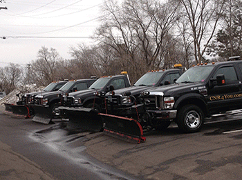
 Commercial Winter Summaries
 As we progress through our Minnesota Winter, C N' R will post snow removal summaries for residential properties in this location. Be sure to check back here often as the snow flies for snow plowing, salt and shoveling updates.
 |
 |
Recent UpdatES -
3/18/26 : 0.25"
During the evening hours of Tuesday, March 17th - we had a band of
snow move through that was “supposed to produce” 1-2 inches of snow, but
instead, it produced about a quarter inch in most places, but as you go east
it got a bit thicker, perhaps some cold surfaces received 1/2 of an inch in
those areas. CNR went out to shovel/salt sidewalks as necessary. Parking
lots salt was used as well. We also touched up parking lots in need from
compaction loosening up from the previous storm or from continued blowing
from rooftops, etc. So, we billed this as kind of a combo effect where we
plowed some areas, shoveled sidewalks, and salted most sidewalks with some
salt, but not a lot of salt was needed in most cases. The work for this was
completed from about 4am-8am on Wednesday morning, 3/18/26.
3/15/26 : 10.5” (Rare Blizzard Warning, therefore a lot of drifting snow)
This storm system was forecasted to bring about 10-20 inches of snow for the
Twin Cities metro, and thank goodness it stayed on the lower end of the
range. This was a Saturday into Sunday snowfall, that helped as well as
people more or less hunkered down on Sunday because of this well advertised
storm system. Operations did go into Monday as well with this snowfall, and
is now the largest snowfall of the season, and the largest in 3 winter
seasons.
Overall, CNR was prepared. We did get hotel rooms for a couple nights close
to our accounts for most employees. This is due to the dangerous nature of
this storm system, and being sure all workers did get to work, and also had
a resting spot. CNR basically did this in 2 shifts, some 3 shifts were taken
and all customers did receive an email from Craig explaining this and a lot
more. So, as far as communicating and being prepared, we feel good about the
action taken early to be sure we were successful with snow removal
operations for a storm like this.
Around 10 inches fell around our accounts. The wind was relentless and
really blew things around, from yard to yard area, off rooflines, etc. It
was very bad in some areas and got very deep. So, we feel charging the 10”+
category was very fair for this event.
Break downs? Yes, we had breakdowns, plenty of them. We had vehicles getting
stuck. We run smaller vehicles as well (Jeeps), and they really struggled as
well. But we dug & grind our way through it all as this is typical for these
types of storm systems.
For commercial lots, we continued to “open” lots through the event because
we have to. We cannot wait to plow 10”+ all at once that has been drifted as
well into 2 foot drifts. We have to keep opening them to stay caught up with
the storm. We feel we were very successful with this approach upon final
clean up as it helps the results and timing before Monday morning. So all
commercial properties were opened 2-3x and then final plowed 1x.
Sidewalk shoveling & salting? All customers were shoveled 3-4x and salted
one time at the end.
Parking lot salting? This was needed as well and this occurred that Sunday
night into early Monday morning.
November
Wednesday, November 26 : 0.4"
According to the National Weather Service, we were supposed to get about
4-8” of snowfall with this system. We did get a lot of rain, then it finally
changed over to snow, and it did snow pretty hard at times. But, the very
warm surface temperatures (even at night) won out. There were many areas
around the Twin Cities that received 1-3” of snow, more to the north, but
around C N’R’s accounts, there was a pretty large pocket of less than a half
inch. During the early morning hours of 11/26, at 2:30am - any accumulation
was not measurable at that time. At 5:30am, it was wrapping up and still,
the warm surface temps kept totals below 1/2 of an inch. The big “but” about
this is that fact that there was a lot of wind with the back end of the
storm, so there was drifting along curb lines, etc.
For commercial properties, we did shovel and salt all sidewalks that require
this service for under an inch of snow. We also plowed some areas of
drifting at some (not all) properties during the day, and then we went back
out to touch more properties out the following night.
Parking lot salt was used heavily due to this precipitation more or less
adhering to the pavement, so during the morning of 11/26, it was a heavy
dose of salt, and then the following night with the re-freeze potential, we
did another dose of salt to all parking lots.
11/29/25 : 5.0"
STORM DETAILS: We had super/very light snow for most of the
day on Saturday, 11/29. That is why we are calling it the 11/29 storm,
although most of the work was done on 11/30 after the snowfall. But, with
the snow rates so light for the entire day on Saturday 11/29, it did not
amount to a lot. By 3pm-ish, we had about 2” on the ground. Then between
about 3pm-8pm, the snow did get a little heavier per se and by 9pm, we had
about 3” on the ground, and then maybe 4” by midnight. Then, the snow died
down sometime in-between that 10pm 11/29 & 2am 11/30 timeframe. Then around
5am on 11/30 (early Sunday morning) - we receive a snow squall warning for
the eastern metro on our APP’s and we were very surprised by this. As this
was happening, it expanded to western metro as well without notice and all
of a sudden we receive another 0.5” - 1.0” of snow until about 8am Sunday
morning. What a long duration snowfall we had, but with only about 5” total.
Some places within our route arguably had about 4-4.5” of snow and some
places were closer to 6” in the end. We are calling it 5” and will be
invoiced as a category B snowfall.
COMMERCIAL PLOWING OPERATIONS: We did not do anything
during the day on Saturday 11/29, because by the time places were closing,
maybe we had about 2” of snow, but before that, it just was not enough to
plow or what we call “open up” properties. But, because of the linger
snowfall, the break, and then more snow surprisingly coming in, we ended up
plowing some lots 2 full times, and even some lots 3 full times. In the end,
we are invoicing this event as a category B as noted above, with one (1)
opening. We feel this is very fair.
We completed 2 rounds of parking lot salt during the event and after the
event as temps started to drop fast, and ground temps were still warm and
cooling fast, so a lot of the snow started to adhere to pavement, and the
slushy areas started to freeze fast.
All operations lasted through the morning of Sunday, 11/30 including
sidewalk shoveling and salting.
Go to: November December January February March April
December
12/3/25 : 0.5"
We had about a 5 hour period of very light snow during the late evening of
12/2 from about 8pm until 1am the next morning (12/3). After that, Craig
drove around the many areas and for commercial lots, was only able to
measure in-between about o.25” - 0.5” - rarely a full 0.5” (because residue
salt was melting it some, but also the pavement at this time is just a bit
warmer than if you measured over a snow packed area for a base), but just
enough to grease up commercial properties and just thick enough where some
needed to get plowed. So, we did a combination of plowing some, salting all
that are signed up for parking lots salting, and shoveling/salting
sidewalks, but only if you are signed up for this service for under an inch.
If you are on a monthly agreement where C N’R only services at 1.0” or more,
these properties were not serviced as we barely even made it half way to
that threshold.
All the services completed within this even occurred from about 1am on 12/3,
until about 8am 12/3.
12/5/25 : 1.0"
SNOWFALL? From about 7am-ish on Friday, 12/5 until about 1pm-ish - 2pm-ish -
we had very light snow. This amounted to just over an inch of snow.
Shoveled & salted sidewalk during the day and into the evening.
All plowing occurred after 6pm and into the early morning hours of the next
day (12/6).
Parking lot salt was applied after midnight, so technically the VERY early
morning hours of 12/6 (Saturday).
NO “OPENINGS” required during this event due to how little snowfall fell.
12/6/25 : 0.2"
The snow for this event fell VERY lightly from late afternoon until about
11pm that night on Saturday, December 6.
On Sunday morning, December 7th - we did clear sidewalks if you are signed
up for under 1” work, plus salted pretty heavily as temps went below zero.
Also, we salted parking lots - those that were open on Sunday, we salted
these parking lots just after midnight Saturday night/early Sunday morning.
Then all day Sunday, 12/7 - it was very cold, and while the sun was up, we
salted all commercial property parking lots we did not salt the previous
night, and then touched up some again that we did salt the previous night.
When the sun was out with a 5 degree temp on Sunday 12/7, that was the time
to try and get the salt to activate.
12/8/25 : 0.2"
We had a band of light snow move through between the hours of about 5am-7am
on Monday, December 8. This coated sidewalks enough to shovel & salt once
again. NO Parking lot salt was used as we just completed this the day before
and there was plenty down already.
12/8/25 : 1.0"
On Monday, December 8, we had a band of snow move in around 5pm and lasted
until about 8pm. About 1” fell from this band on top of what we had that
morning as well if you look at the last snow summary. Craig actually
officially measure 1.1” in Eden Prairie from this new band.
That night, all commercial parking lots were cleared from curb to curb.
No “openings” charges. Not necessary.
Some Parking lot Salt was used, but used sparingly for only the properties
in more need due to the next snowfall coming in the next day which was a big
storm.
Commercial sidewalks were cleared as well overnight if you are signed up.
12/9/25 : 4-6” - invoiced out at a Category C plow with one
“opening” (more explanation below)
Most of the snow on this event fell from 1pm 12/9 until 7pm 12/9. Another
“sneaky” 1-2” fell from about 11pm 12/9 until about 3am early morning of
12/10. Due to all these factors, we had to plow commercial properties
several times including openings. We also received another small band of
snow during the morning hours of 12/10 - so that added a bit more. Due to
this storm having multiple bouts, it took a lot more work to get things
cleaned up. Although we may have not reached exactly 6 inches, we are going
to invoice this event at 6 inches which is a category C event, and then one
“opening” for all properties even though we plowed most 3x +
We feel this is very fair instead of making this “multiple events” which
would cost our customers more.
Commercial sidewalks were also shoveled at least 2x, sometimes 3x due to the
multiple rounds. Salt was used.
Parking lot salt was used as well for all properties.
12/12/25 : Frz drizzle/dusting of snow
We had a band of freezing drizzle and light snow come through between about
7:30am-9:00am on 12/12/25. This coated parking lots and sidewalks with ice
and then snow on top of the ice. This was associated with an arctic front
that was poised to bring our coldest weather of the season for the next few
days after.
So, we had to salt sidewalks and parking lots as fast as possible before the
cold air arrive so the salt would activate. We completed this during the
morning hours of 12/12.
Early morning - 12/18/25 : Rain, flash freeze preventative
During the night of 12/17 into 12/18, we had several bands of rain move
through within the warm sector of a strong Alberta Clipper that was
racing across the international border. Temps had risen to close to 40
degrees over night as the rain came through.
Waking up early on 12/18 (Thursday) - the final band of rain was about
to end around 7am and things were very wet out there in the middle of
December. Next to come in was the forecasted cold front which was
supposed to drop our temps to below freezing by noon and then fall about
3-5 degrees per hour through the late afternoon and evening.
This is a scenario where “flash-freeze” is a big concern, therefore we
went out to treat all parking lots with salt and also sidewalks. There
was no ice upon treatment, but things were very wet and about to freeze
solid.
A couple things about the rain/wetness:
Due to the rain, this washes away all salt residual. This is important
because it will not work once things freeze again. So it is very
important to get the salt put back onto the pavement/sidewalks.
Also, even though things were not frozen yet, one would say: “What is
the point of putting salt on wetness/water? Why not wait for it to
freeze?"
Answer: When you get a flash freeze and temps are dropping that
significantly, it is more difficult and slower to melt the ice once it
has frozen. When you apply salt while wet, it also soaks up the water,
therefore surfaces won’t even freeze if they have dried.
12/19/25 : 1.2"
We had more snow move in on the cold side of a pretty potent Alberta
clipper. The snow came with very strong winds, actually breaking records
for gusts in MN, SD, and ND for this time of the season.
This wind driven band of snow made it here on Thursday, 12/18 at about
3pm-ish, and lasted until 7-8pm that evening.
In the end, it was tough to measure, but we did get a median for
multiple measurements of 1.2”. The airport was 1.1”. And Chanhassen
reported 1.0”.
We plowed all commercial one-time through (no openings) during the night
of 12/18 into 12/19.
Same with shoveling sidewalks and re-salting sidewalks as the temps
really dropped and things needed yet another coating of salt even though
we just coated them about 12 hours prior to starting to work this event.
Parking lot salt was needed heavily as you can imagine with the very
cold (below zero) temps, and very cold wind.
12/22/25 : FRZ rain, 0.1” of ice
Between about 3am & 5:30am on Monday morning, 12/22 - we were under a
freezing rain advisory for 0.1” of ice with this band of sleet and then
rain that moved through fall on top of frozen pavement temperatures. I
coated things with sleet, ice, and slush. We salted all parking lots in
need and sidewalks.
12/26/25 & 12/27/25 : FRZ precip/fog
As the Christmas holiday went by, we were in a warmer airmass just a bit
above freezing, but we continued to get bouts of dense fog, turning into
freezing fog. Bands of rain which made things very wet, then the temps
would drop close to freezing, etc. This happened for multiple days in a
row, especially 12/26 & 12/27 which was a Friday (work day) and the
following Saturday. For some properties, we did multiple rounds of
parking lot salting, and we understand that there has been a lot of
salting since Thanksgiving, but it just has been one of those months
where we really need to continue to put salt down. You get these wet
conditions and all the residue from previous salt applications wash away
and go down the drain. So, again, multiple rounds of salt for some in
parking lots, bu for some we did not salt at all or maybe one time. If
your place of business was closed, we did not salt. Also, sidewalks were
salted for some cases, especially on Friday morning 12/26..
12/28/25 : 6.0” (seriously wind driven)
This was more or less a blizzard situation, especially for all the counties
immediately west of the Twin Cities where they had blizzard warnings, but
for the metro, we stuck with winter storm warnings for 6”+ snowfall along
with winds gusting as high as close to 50 mph at times. The actual sustained
winds were the most impressive to us because it just would not stop blowing
very hard, and then you get a gust that could knock you off your feet.
All the snow fell on 12/28 (Sunday).
Details:
7am-9:30am - freezing rain to snow.
Temps then started to drop fast with the winds coming in, created flash
freeze conditions.
Then a very heavy band of snow until about noon-ish or so, then it was just
off and on light to moderate snow until about midnight-ish. Some snow
showers after but the wind was blowing so hard, it was tough to tell if it
was snowing or if it was just blowing.
A “tough to measure” type of storm, but the winds made for more snow in many
areas than actually fell because you have regular blowing and drifting, you
have snow blowing significantly from roof tops whether it is a house or a
commercial building.
All parking lots were cleared 2-3x PLUS THE NEXT NIGHT we had to go back out
and do some more “wind-driven-snow-plowing”. All accounts were invoiced for
a 6” snowfall, plus 1-2 openings. And some were invoiced for a 3rd “opening”
charge with the extra plow the following night with the wind driven snow off
roof-tops and open areas. What we did is we checked on most properties after
the snowstorm was done because of the continuing wind. If a parking lot did
not need really any extra attention, then we did not re-plow those areas,
therefore no charge. For those we had to touch up we feel it is very fair to
just charge for another “opening” - not a full plow.
This system was a significant system - yes with snowfall somewhat but more
or less about the wind where we would plow, then snow and wind would just
keep blowing into parking lots. We did our best to make the correct
decisions and take care of our customers the way we felt was right to do and
for top notch service. If you are reading back on this after the fact, if
you remember - the highways, main roads, side roads remained very ice packed
and very dangerous for several days after this system because of the flash
freeze situation and all the wind driven snowfall was getting packed and
adhered to the pavement. It was a mess.
Speaking of icing - with the parking lot salt - we had to put on several
applications, along with treated salt to try and get parking lots down to
reasonable icing conditions. We did our very best.
All properties were shovels 2-3x as well and salted multiple times as we
were shoveling. These totals on this wind-driven event because accelerated
especially from snow blowing off roof tops.
12/30/25 : 0.25"
About a quarter inch of thicker snow fell early during the morning hours of
Tuesday, December 30. Sidewalks needed shoveling and re-salting once again.
Some parking lots needed re-salting as well.
This was all done between about 8:30am-12:00pm that morning.
Night of 12/30 into the very early morning hours of 12/31:
(SLUSH PLOW)
If you ready the previous short summary, we had about a quarter inch of snow
early during the morning of 12/30. As talked about in that summary, we did
shovel commercial sidewalks and salted sidewalks. We also heavily salted
parking lots. That salt loosened up the compacted snow from the last large
snow storm and now this continuous light snow events we have been getting,
so cars are packing things down hard.
Late in the night on 12/30 and very early morning of 12/31 - we sent a truck
out to complete a full plowing on the parking lots in need that had a lot of
slush on them because of the combination of temps briefly getting above
freezing and/or the salt that was applied. We had a couple requests to do
this special plow, but while we were out there, we checked on several more
properties that needed another “shave” to help with that loose slush and
used our discretion.
12/31/25 : New Year’s Eve = 1.25"
During the morning hours of Wednesday, December 31st - we received
another 1-1.25” of snow from a clipper system. Most of the snow was done
by about noon/1pm that day.
NO “OPENINGS” OF parking lots was required. But due to the “holiday”,
most businesses were closed early enough where we were able to plow them
between about 4pm & 10pm, and a couple we had to plow after midnight
which would be technically Jan 1st at that point.
Shoveling/salting of walkways was completed between about 1:00pm -
4:30pm that afternoon.
No salting of parking lots for this exact system. There is a shortage on
salt, so at the time of writing this, it is unclear how things will go
as the State of MN released a statement seizing all private sales -
meaning: The state gets first rights of any salt available in the state.
This will cause problems for future salting.
Go to: November December January February March April
January
SUNDAY 1/4 - TUESDAY 1/6 : Freezing precipitation
This summary is involving 2 events, but the first event was very minor.
1st event = Monday Morning 1/5 = we had a band of sleet/freezing rain go through
- salt residual already in place made the event fine during the day on
Sunday, but early Monday morning 1/4 = we did send the salt truck to
“spot” salt certain areas that froze overnight. Not all properties
received parking lot salt, but some did. No attention was needed for
sidewalks.
2nd event = Monday Night 1/5 into early morning Tuesday 1/6 = this was a
pretty incredible January rain, with ground temperatures frozen, and air
temps hovering right around 32 degrees, nearly 1/2” of rain fell with a
band that moved through. Right away, it started to create VERY icy
conditions, but as the rain did get heavier, it started to decrease the
amount of icing there was. But there was a lot of water, dense fog,
moisture hanging around after the rain ended, then things started to
freeze again.
All commercial parking lots and sidewalks were HEAVILY salted during the
early morning hours of Tuesday, 1/6. After this very WET event, foggy
conditions along with possible freezing fog coming, any future salting
from this event will be labeled on a different “snow summary” than this
depending on what happens next with falling temps and so much moisture
around. We are predicting quite a bit of re-freeze, so future “snow
summaries” likely needed with these details.
1/7/26 : Re-freeze
After all the rain/freezing rain, freezing fog along with dropping temps over
the past couple of days - we did send the salt truck out to monitor properties
and apply salt where necessary only. Some parking lots received a full dose of
salt due to re-freezing conditions during the early morning of January 7th, and
some received “spot treatments” - for areas such as where cars park and the ice
has not melted yet, or maybe roof downspouts that have been pouring water out of
and freezing.
No sidewalks salt was needed. Craig drove around checking sidewalks, and the
current residual on the sidewalks was taking care of business, so no re-freezing
happening.
1/8/26 : Rain that froze
On Thursday evening, 1/8, we had a storm system to our south that moved just
enough to the north to cover the metro with plain old rain. There were some
forecasts stating that it could switch to snow, so we were on call through the
event, but temps and dew points just did not fall enough to switch the rain to
snow. So, again, just a plain old January rain with temps right around 34
degrees during the event, but after the even ended around 9/10pm that evening,
temps dropped into the 20’s through the rest of the night and the next day temps
did not rise above freezing.
With all that said, commercial sidewalks were salted and commercial parking lots
were also salted. We did a “normal” salting across all areas, but we also
focused on some areas where build up has occurred from past events, or if you
have a gutter coming off the roof that has been pouring water into the parking
lot or sidewalk and then freezing.
All work was completed between about 4:30am & 9:30am on 1/9/26 which was a
Friday.
1/14/26 : Re-freeze (explanation below)
Prior to 1/14, we had 2 days in a row with temperatures in the 40’s which
created a lot of melting. And when we get a lot of melting, run off from snow
banks, run off from building downspouts freeze when temps drop. Also, areas
where this run off puddles, creates a small ice rink. And during the night of
1/13 into the morning of 1/14, we had strong winds and dropping temps, from
about 41 degrees down to about 10 degrees. Speaking of the winds, this helped a
lot. How? The winds blew quite a bit before temps went below freezing. This
dried areas up that were damp, but not “puddled” - so this was not a
“widespread” flash freeze event in the end. But we did still go around to all
properties and do the proper “spot” salting needed to the areas that did freeze.
1/16/26 : 1-3"
On Friday, 1/16 - snow slowly fell for most of the day, and a “micro” heavy band
developed basically right across CNR accounts where more like 2-3 inches fell.
This amount of snow was not on all accounts, so if you did not have 2-3” from
this band, then you were at about 1-1.5 inches.
This micro band set up in a NW to SE line from about Buffalo to Maple Plain to
Minnetonka area and N. Eden Prairie.
This snowfall lingered and lingered and lingers, lasting until about midnight
1/16.
All commercial properties were plowed from curb to curb and shoveled during the
overnight hours of 1/16 - 1/17.
NO PARKING LOT SALT WAS USED as it was not that slippery, and we had another
snow moving in during the next couple of days.
Salt was used on sidewalks as normal.
1/18/26 : 1.0” - 1.5"
Very light snow fell on Sunday, 1/18 between about 8am & 5pm. Similar to
last event, it was just a slowly accumulating snowfall that added up to
at least 1.0” (1.1” in Eden Prairie) - but there were some measurements
close to 1.5 inches.
Although this snowfall was very similar to the previous event on 1/16,
the big difference was how it ended.
HOLY COW! Big time winds! When the snow ended, big winds blew from about
5-6pm 1/18 until about 2am 1/19.
AND THEN, the temps plummeted!
So, for commercial properties, huge amounts of snow blowing around from
rooftops and other areas. So, some properties we had to plow a couple
times, but we are only charging for ONE curb to curb plowing for this
event, and again, like the previous event (1/16), there are no “opening”
charges.
All Plowing was completed during the night of 1/18 into early morning
1/19.
Sidewalks were shoveled and salted, but the salt was very slow to
activate - had to use a lot due to the cold.
SAME WITH PARKING LOT SALT. Because of the temps dropping all the way
down to -10 degrees, we used “treated” salt and had to salt properties
heavily. This was done overnight with the anticipation of the sun coming
out the next day to hopefully activate the salt better even thought our
forecasted high temperature is only 3 degrees. “Regular” rock salt would
not do anything, only treated.
EARLY MORNING OF Wednesday, January 21st : Coating of snow
Overnight we had a coating of snow, and at about 4am in the morning, CNR
crew went to each property to see if & what needs to get done. Some
properties did not need anything (existing salt residue took care of it)
while others needed a touch up shovel & salting. Then, later that
morning, we had a decent band of snow move in, which ultimately we later
plowed (see next snow summary), but we had to re-touch more sidewalks
and salt for “daytime” business hours. Even a couple lots needed some
minor plowing.
1/21/26 : 1.0” of snow
If you look at the previous snow summary, this is the “second half”
explanation of that particular snow event which came in waves.
The final wave came later morning and lasted until about 4-5pm that
afternoon/evening.
All commercial properties were fully plowed, and shoveled, and salted,
and parking lot salted once again. During the day while it was snowing,
we put a layer of salt down (which was huge!) because the temps briefly
rose well into the 20’s and that was our opportunity to melt as much as
possible. Then the temps went downhill fast, and then we had -20 degree
below mornings for a couple days in a row if you remember. So, after we
ended up plowing this snowfall, we re-salted because everything froze up
again, but it was much LESS WORSE that it would been if we did not salt
during the daylight hours.
1/23/26 : Severe Wind
During the day on Thursday, January 22nd - we had a major Arctic
Blast move through and it brought off and on snow squalls along with major
winds. The snow did not amount to much at all due to the dryness of the
flakes, but the winds blew snow around that has fallen over the past few
days. This made for certain commercial properties to get “drift in” from
open areas, and a lot of blowing off buildings. This created a coating over
sidewalks, and also in some cases, it created blowing snow into parking lot
areas and along snow-banks in parking lots.
During the very early morning hours of Friday, January 23 - we went out to
check on sidewalks - we shoveled what was necessary, but NO SALT was used
because temps were at 21 below zero. If you are reading back on this, it is
that cold blast that closed schools state wide on Friday, January 23.
Also, we scattered plowed some areas with drift-in snow to clean
things up a bit.
Go to: November December January February March April
FEBRUARY
2/1/26 : 2.0"
About 2 inches of snow fell during the early morning and daylight hours of
Sunday, Feb 1. Several bands came through, with some breaks inbetween - this
happened earlier. Then a more widespread band moved through about
9am-1pm-ish on Sunday. Some freezing wet precipitation mixed in as well, but
all n all, about 2 inches of snow.
For parking lots and sidewalks, we waited until things closed (if you were
open) to plow lots curb to curb. No openings were necessary.
Sidewalk shoveling and salting was done during the daylight hours.
Full curb to curb plowing occurred after sun-down and through the night and
into very early the next morning (Monday, Feb 2)
Parking lot salt was applied during the early morning hours of Monday, Feb
2.
2/19/26 : 7.0"
DETAILS ABOUT THE STORM ITSELF:
Late Tuesday (2/17) night into early Wednesday (2/18) morning, we had a
bunch of bands/scattered RAIN showers move through and even a bit of thunder
for some close to home as we were on a warm side of a stronger low pressure
system moving in. This LOW continued to spin over Minnesota there after and
create quite large amount of snow along the north shore as the upper air was
flowing from SE to NW over lake superior. This enhances (lake effect) the
snowfall up there, as this LOW basically sat in Central MN and spun.
Around 8-9am on Wednesday (2/18), the rain became snow and remained snow for
basically the rest of the time. But, it had been so warm for a longer period
of time before this snowfall came (more on the warmth below) - it was just
wet on roads. It was even melting on contact on raised items and grassy
areas for the rest of the morning.
As the system gathered some strength and started “banding”, the snow became
more steady during the afternoon and about 1-2pm-ish is when we started to
get accumulation on grass, raised surfaces, and eventually pavement. Keep in
mind, this system was supposed to be “no accumulation expected” from all
weather outlets. All of a sudden we have about 2-3” on everything by about
5-6pm that Wednesday evening. There were big differences in forecasts on
when it was supposed to stop snowing. Guidance started at 9pm Wednesday
evening it was supposed to be mostly done. Then switched to midnight. Then
switched to 3am, and then the final Winter Weather Advisory change to 8am.
Wow! It just kept snowing all night and into Thursday morning without really
any warning.
On the south side of the spinning low, it wrapped in just enough cold area
and created a thin finger of snow that again “banded” and just sat over the
top of the SW twin cities for the entire night. It was actually crazy to see
if you were in one of our trucks witnessing a relentless band of snow that
just kept spitting out moisture. With this band, of course it set up right
over the top of the cities that CNR services and by 7:30am on Thursday
morning, we had a total of about 6-8”. Very close to 8” of snow in many
spots, at least 6-7 inches in all spots that CNR services. Crazy!
OPERATIONS FOR COMMERCIAL:
When this system was all of a sudden creating accumulations, this occurred
at the worst time during traffic on Wednesday (2/18) afternoon. We were
still thinking at 3pm that day that we may not even be plowing, so all
employees of CNR were on call and waiting to see what happens. When we did
figure out that we will be plowing this, we started to call workers in, but
at that time, it was a mess to get in, and it took hours just to get most
people in. If you remember, all the roads became glare ice and it was
horrible with car after car in ditches, highways/back roads all blocked up.
Could not get anywhere. This ultimately delayed our starting time, but
nothing we could do about it. Between about 4-8pm is when slowly but surely
we got operations going, just depends on what person/truck and how long it
took to get in. There were a few workers that we told to hold off on driving
in until “after traffic” because how dangerous it was. We would rather start
a bit late than lose workers coming in with accidents, or sliding off roads,
etc. But, going back to what we eluded to earlier in this blog, at that time
calling everyone in, we were thinking that most of the accumulation was
supposed to be done by 9pm or midnight at the latest which totally became
VERY inaccurate.
With all that said above, essentially all commercial properties were plowed
2-4 times from the evening of Wednesday (2/18) through the entire night and
into the very early morning hours of Thursday (2/19) - even some more
“openings” during daylight hours on Thursday (2/19). Then a final plow was
completed for a lot of properties late during the night of Thursday 2/19
after we took a break once things were in “good enough” shape for the rest
of the day on Thursday 2/19.
Because of the relentless style of the snow continuing along with several
changes in the forecasted “end times”, we were scrambling all night long to
keep things cleared for our great customers to come into on Thursday
morning. But, let’s face it, if it continues to snow until 7:30am, there
were really no parking lots that were perfectly clear. But we at CNR were
very proud of the fact that most lots only had about 1-2” of snow on them by
about 9am, and we went around to even more lots after 9am to open up for the
business day a bit more. It was a very tough battle.
And the snow started to turn to ice as we plowed it - after we clear it, the
residual froze because air temps and surface temps slowly dropped in and
around 28 degrees. Our plan then was to clear things the best we can and put
down salt during the day on Thursday and not later on before things could
freeze too much to help melt and dry things out. This was a brilliant call
to make over many other companies making different decisions and holding off
salting until the next night. You can tell the difference between CNR
parking lots with hardly any ice by Friday morning (2/20) than other parking
lots with glare ice. Very noticeable and we were very proud of our decision
making.
For shoveling and salting of sidewalks, we did most sidewalks 2-3x. Not
salting every time, but we kept going back to things as it snowed to make
sure sidewalks were as clear as possible by sunrise Thursday morning 2/19.
In the end, for this “Billing” - we are charging for a 6-8” snowfall with
1-2 openings added on top. We do feel that many of our commercial properties
we take care of received over 8 inches of snow, but we are not charging that
level as we had to do multiple openings for most, and we thought it was more
fair to charge the proper amount of “openings” along with the 6-8” category
for total snowfall.
2/24/26 : Freezing rain
Between about 10am - 11am on Tuesday morning, February 24th - we
received a thin band of frozen precipitation. Started off as sleet, changed
to plain old rain, then brief snow on the tail end. Lasted about an hour or
so overall. But the temps were in the upper 20’s and the surface temps were
well below freezing due to the recent cold spell we have had. Therefore
everything froze on contact where salting was required.
We salted all sidewalks and parking lots during the day time hours between
about 10:30am-1:00pm - temps did start to rise, but stayed wet there after.
**THAT NIGHT OR VERY EARLY THE NEXT MORNING, we went out for “re-freeze
conditions” to spot salt parking lot areas in need as temps dropped very
fast later in the afternoon and during the nigh time hours. So, there will
be technically 2 salting events that go with this freezing rain event.
Go to: November December January February March April
March
3/7/26 : Coating of wet snow
We received a coating of snow during the very early morning hours of
Saturday, March 7th. Because it was a Saturday, we attended to slippery
conditions that existed to properties/business that would be active on
Saturday. Before we received the coating, we did get some freezing rain as
well. So, it was slick for awhile there before temps warmed up and melted
things off. This was all completed prior to 8:30am Saturday morning. No
sidewalk work was necessary, only salting of some parking lots.
3/11/26 : Heavy coating of snow
During the overnight hours of Tuesday, March 10th into the early morning
hours of Wednesday, March 11th - we had bands of snow move through. Some
rain mixed in early, but most of what fell was snow, but only had a max of a
half inch on “COLDER” ground. Meaning like north sides of buildings where
the sun does not hit. But, in parking lots/sidewalks where sun hits, there
was just a quarter of an inch or less, or sometimes melted all the way, but
it was starting to freeze. All commercial parking lots required a rather
thick layer of salt to take care of the snow & re-freeze. All sidewalks were
salted and or shoveled/salted during the very early morning hours of
Wednesday, March 11th.
3/15/26 : 10.5” (Rare Blizzard Warning, therefore a lot of drifting
snow)
This storm system was forecasted to bring about 10-20 inches of snow for the
Twin Cities metro, and thank goodness it stayed on the lower end of the
range. This was a Saturday into Sunday snowfall, that helped as well as
people more or less hunkered down on Sunday because of this well advertised
storm system. Operations did go into Monday as well with this snowfall, and
is now the largest snowfall of the season, and the largest in 3 winter
seasons.
Overall, CNR was prepared. We did get hotel rooms for a couple nights close
to our accounts for most employees. This is due to the dangerous nature of
this storm system, and being sure all workers did get to work, and also had
a resting spot. CNR basically did this in 2 shifts, some 3 shifts were taken
and all customers did receive an email from Craig explaining this and a lot
more. So, as far as communicating and being prepared, we feel good about the
action taken early to be sure we were successful with snow removal
operations for a storm like this.
Around 10 inches fell around our accounts. The wind was relentless and
really blew things around, from yard to yard area, off rooflines, etc. It
was very bad in some areas and got very deep. So, we feel charging the 10”+
category was very fair for this event.
Break downs? Yes, we had breakdowns, plenty of them. We had vehicles getting
stuck. We run smaller vehicles as well (Jeeps), and they really struggled as
well. But we dug & grind our way through it all as this is typical for these
types of storm systems.
For commercial lots, we continued to “open” lots through the event because
we have to. We cannot wait to plow 10”+ all at once that has been drifted as
well into 2 foot drifts. We have to keep opening them to stay caught up with
the storm. We feel we were very successful with this approach upon final
clean up as it helps the results and timing before Monday morning. So all
commercial properties were opened 2-3x and then final plowed 1x.
Sidewalk shoveling & salting? All customers were shoveled 3-4x and salted
one time at the end.
Parking lot salting? This was needed as well and this occurred that Sunday
night into early Monday morning.
april